 |
|
|
Did you ever want to stop the world and get off? As America’s media hyped and second-guessed every move by President George W. Bush and his advisors while they planned a war against Iraq, we wanted to escape what seemed, to us, contrived. Since we had no control over circumstances other than to sign peace petitions and attend vigils, we opted to remove ourselves from the milieu.
|
 |
|
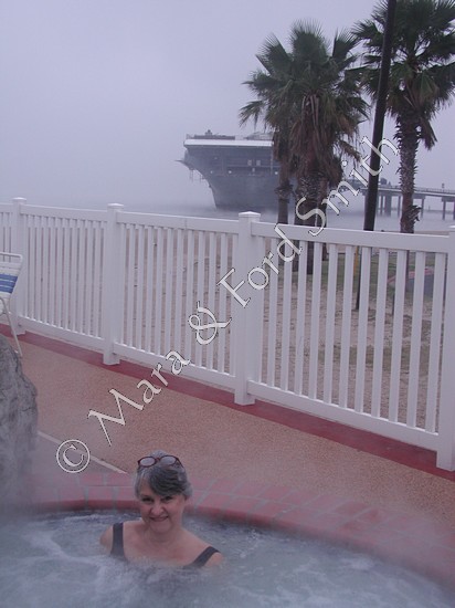
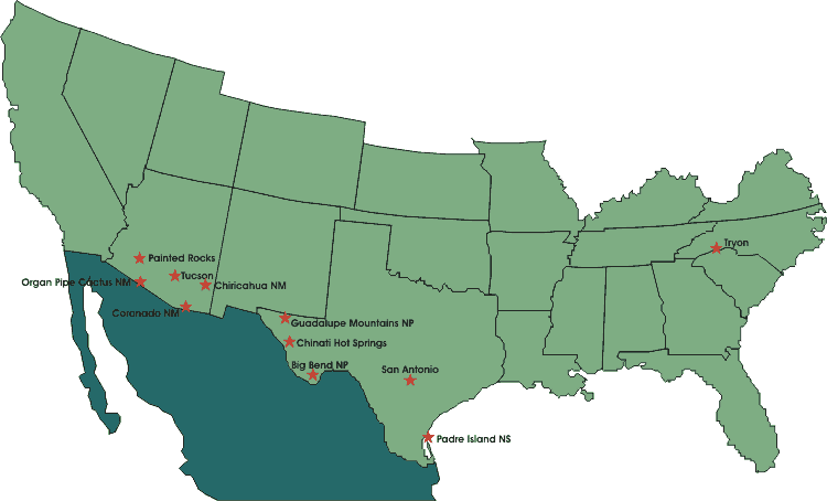
Little did we know how difficult it would be to isolate ourselves from warmongering and to insulate ourselves from cold. When we drove up to the entrance gate at our first national park site, a ranger told us that the wind chill was 26 degrees Fahrenheit on the beach at Padre Island—brrr! Ensconced in a Corpus Christi motel for the night, we looked out the lobby windows and discovered an aircraft carrier, the USS Lexington, anchored offshore. We were reluctant to turn on the television for another report on W’s upcoming war, but we needed a weather report. It was snowing at almost all points north of us in Texas! It looked as if we needed to drive west for another full day. Then we might be out of the arctic storm, but we’d still be in Texas. |
In West Texas, we started seeing signs of increased border patrol activities. Parallel dirt roads had been bulldozed between paved roads and fences. Each morning, the border patrol was checking the dirt for footprints of “undocumented aliens” or “UDAs.” Then, officers were dragging these roads with old tires to clear those prints in order to catch the next group of people struggling for a better life. Lots of metal-building checkpoints had been erected along paved roads. Young men in dark uniforms would eye us and our vehicle, ask if we were United States citizens, demand where we were from and where we were going. We were getting our dose of another reality. We had to question how effective these means were against W’s war on terrorism. |
As we approached Big Bend National Park, we paid the highest price for gasoline on our trip, $1.879 per gallon. At these prices, we felt, all the big oil companies must be doing well financially. We wondered if the imminent war was a pay-back to these corporations for their political campaign contributions and, after the war, if their “expertise” would control Iraq’s oil flow. |
|
|
When we felt things could get no worse, the clouds cleared. A friendly ranger at Big Bend’s entrance gate told us where to find an unusual buffalo petroglyph, petrified wood, and fossils. At the visitors center, we asked another ranger for her favorite backcountry site. |
|
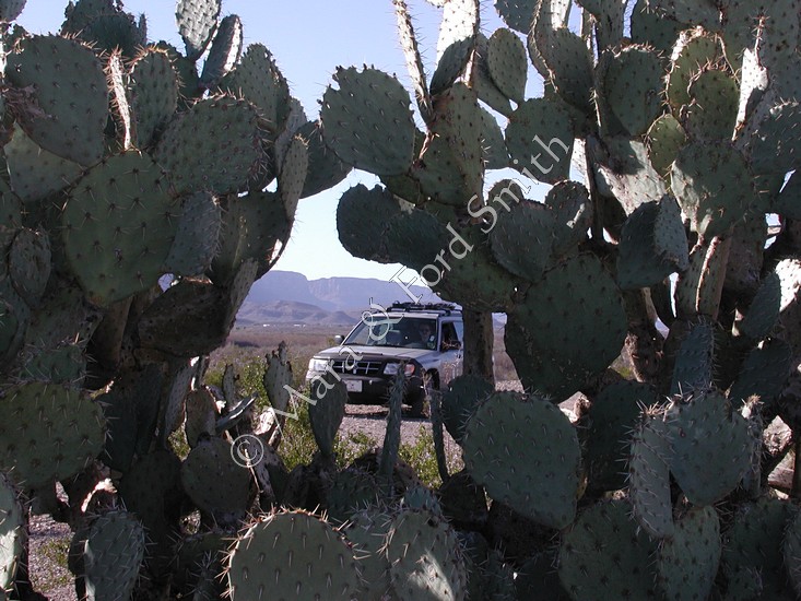
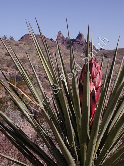
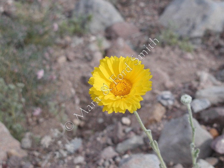
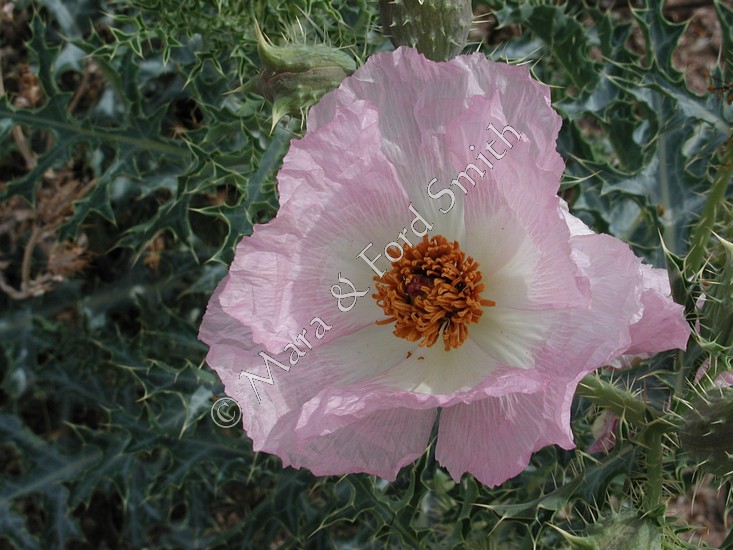
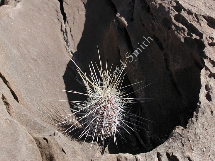
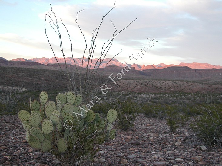
About the size of New England, Big Bend National Park offered fantastic scenery. One Indian legend ascribed the Creator as throwing all His leftovers into the Rio Grande River, forming the big bend that’s so distinctive on the Texas map. We drank in the mountains, the sun, the blue sky, the cacti and spring wildflowers of the Chihuahuan Desert. On a mesa, once the site of the town of Buenos Aires, our campsite had a 360-degree vista that included Mule Ears, Castolon Peak, cliffs holding Santa Elena Canyon, an old Rio Grande riverbed.... Ahh, this is what we needed to restore our spirits. |
|
|
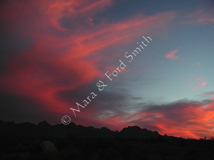
We relaxed. In the afternoon, we rigged a tarp for shade. In the evening, we reveled in a vivid sunset, vast on the horizon. In the night, we were mesmerized by bright stars and serenaded by coyote song and owl hoot. One morning we ran; the next morning we hiked. |
|
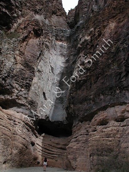
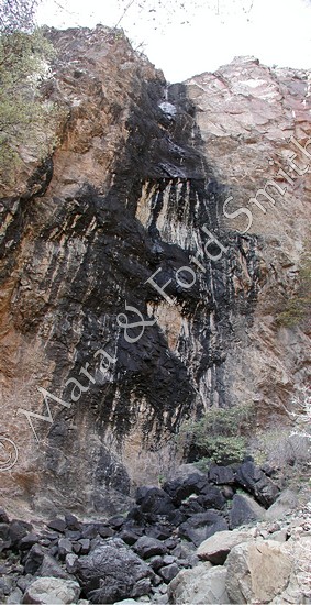
Not wanting to repeat other successful adventures in the park (such as strolling to The Window, tramping the South Rim, viewing yucca in full bloom as far as the eye could see at Dagger Flats, driving the Old Ore Road, camping at Ernst Tieneja, soaking in hot spring waters at the remains of an old spa), we chose the awesome Burro Mesa Pour-Off. See Mara?>>> |
|
|
Refreshed, we continued to Guadalupe Mountains National Park, the world’s largest exposed Permian reef. We arrived at dusk, in time to select a campsite that looked as if it would receive the first rays of morning sun. Overnight, the weather changed. The wind rose and the rains came. In the morning, our tent was coated with ice. In our quest for warmer temperatures, we hurried through the high elevations of New Mexico. |
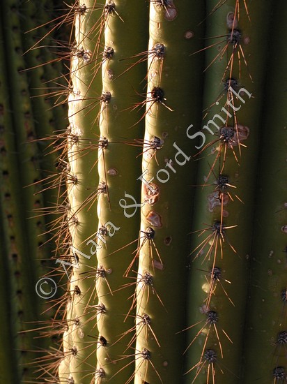
In Arizona, we anticipated the first saguaro cactus. We spotted it in Davidson Canyon outside of Tucson. Too, we found warmth again—from sun and from friends. We rendezvoused with Katherine Josten (founder of the Global Art Project), Barbara and Doug Siegel (she’s the former botanical director at the Arizona-Sonora Desert Museum; he’s one of the co-managers of Tucson Mountain Park; recently married, they’re planning an environmental camp), El and Bill Fiero (retired teachers, authors, and world travelers). Coming and going, we shopped our favorite gourmet grocery that has opened in Tucson, Trader Joe’s. |
|
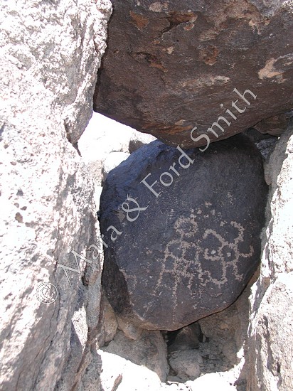
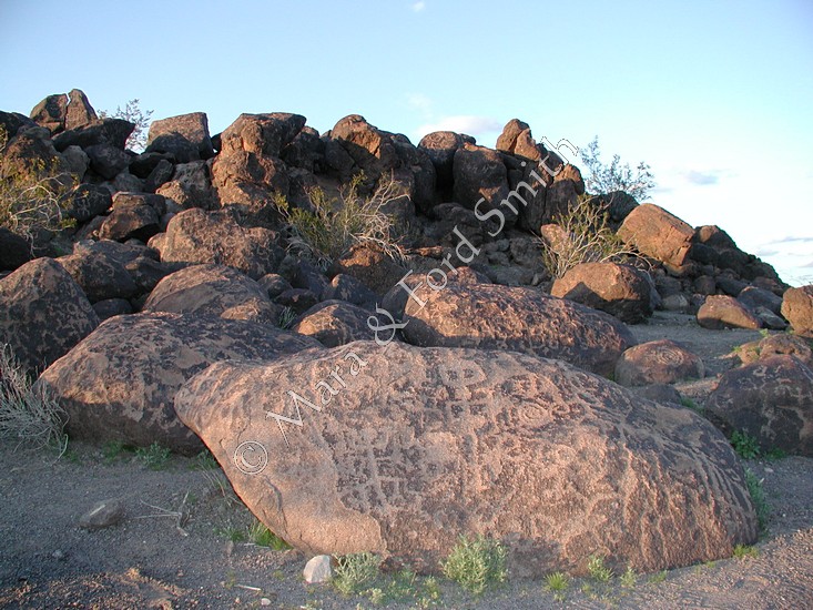
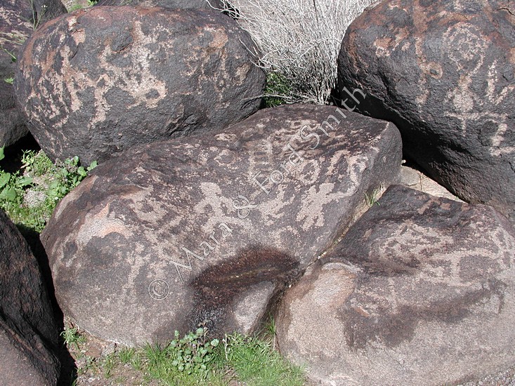
On the Arizona map, we had spied a place, Painted Rocks, that promised Native American archeology—probably, pictographs or petroglyphs. The Bureau of Land Management site was unimposing at first glance. This pile of rocks, however, may have been engineered, according to former campground manager Candace Batchelder. Her theory is: Tribes came from four directions to construct these rocks into a mirror image of the skies about 1050A.D. Rocks were arranged to reflect the animals that Native Americans saw in the stars—a serpent, a turtle, a crocodile.... One rock was placed on a tripod of other rocks to function as a bell, a call to worship. In addition, Batchelder had located sighting stones, including one implanted with obsidian to calculate the vernal equinox, the time to plant crops. |
|
|
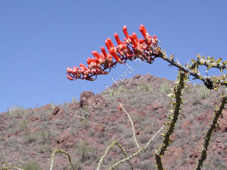
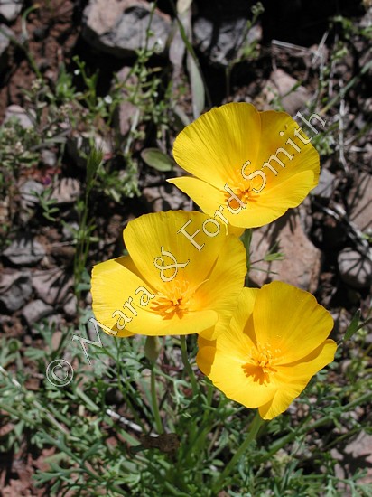
Through spring rainstorms, our drive to Organ Pipe Cactus National Monument was intensely colorful. Yellow flowers carpeted the desert. We’d never seen the Sonoran Desert so green. There were black mountains, red mountains, striped mountains. |
|
At the national monument, volunteers recommended a hike to Bullpasture to see more wildflowers. Reaching the summit of this moderately strenuous hike, it was hard to believe ranchers would drive cattle to this place for spring foraging. |
|
 |
|
We camped at Alamo Canyon, near one of our favorite red rock formations that reminds us of a Native American woman with a papoose on her back. Here we hiked adjoining canyons and took photographs of the uncommon (in North America) organ pipe cactus. |
|
Wherever we drove in this monument located along the Mexico border, there was evidence of people walking south-north trails—empty water jugs, articles of clothing.... According to a handout from the national park service, “These ancient and intricate routes extend hundreds of miles through the Sonoran Desert.”... “In 2001, it was estimated that more than 200,000 undocumented migrants passed through the monument.”... “Most often it is the men who come north; occasionally women, children, and even infants may accompany them. These people are not criminals, but they are a desperate group. They carry little—a small bag with food and a few possessions, and gallon jugs of water.” |
|
| Unlike illegal migrants, we had many creature comforts in our air-conditioned vehicle. Again and again on our return trip along the Mexican border through the Coronado National Forest, we were struck with the obstacles these thousands of people faced each day. Meanwhile, we camped in relative comfort: the first night on a hilltop overlooking Nuevo Corrales and Hell’s Gate with a backdrop of Baboquivari Peak; the second night beside Bear Creek flowing over dusky lavender boulders. Along this creek, white-and-brown spotted sycamore trees had started to leaf, forming a palette of spring colors. |
|
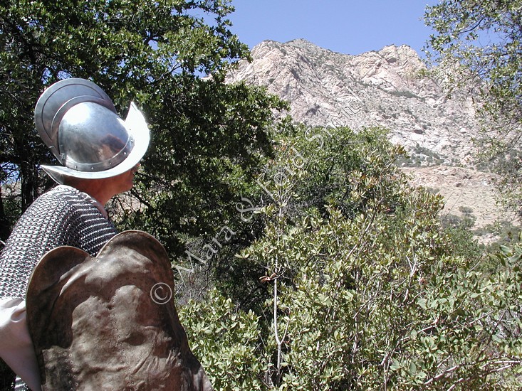
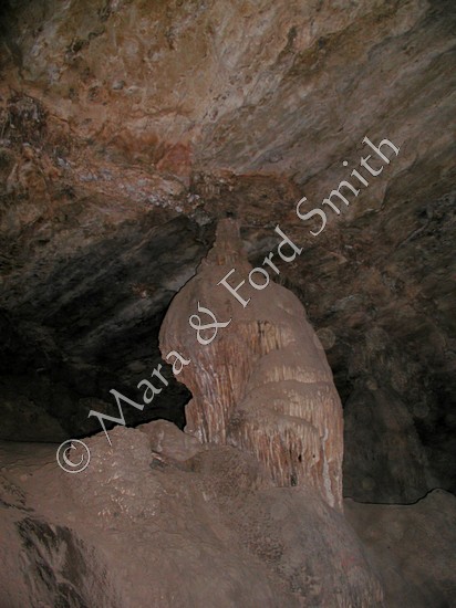
At Coronado National Monument, we photographed Montezuma Pass. At the visitor center, Ford donned a conquistador’s chain mail and helmet. Hiking up Montezuma Peak to no-longer-active Coronado Cave, we attempted to digitally capture stalagmites and stalactites. Our experiences were teaching us that we found fascinating features at the base of these mountains, these islands in the sky—canyons, pour-offs, caves, different ecologies....
|
|
|
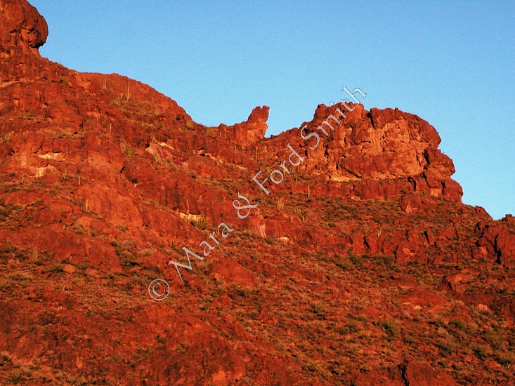
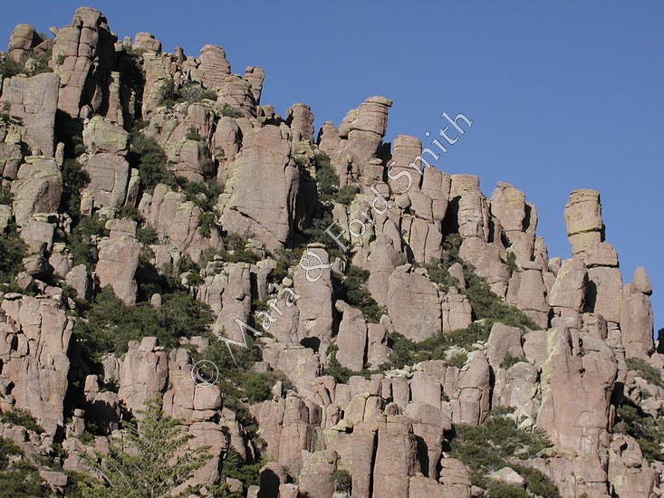
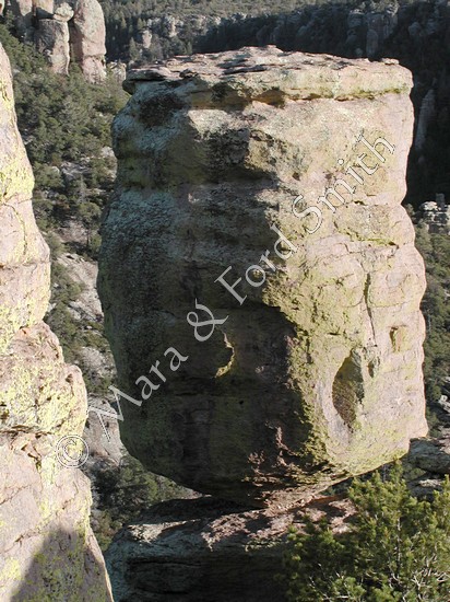
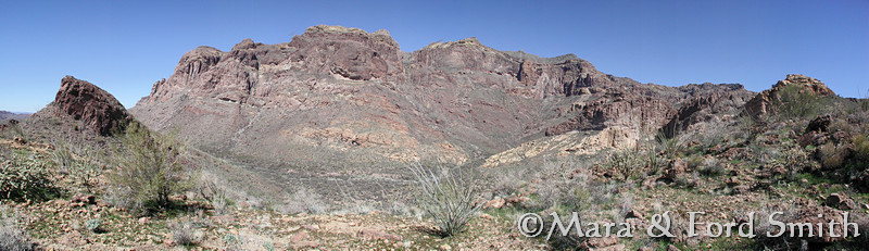
Nearing the next set of mountains, we began to see green pine trees and gigantic rock spires. In the late 1800s, in what is now Chiricahua National Monument, Geronimo and his Apache warriors repeatedly evaded U.S. Army soldiers. We arrived in time to take a sunset photos along the scenic drive. The next day, we repeated the trip, photographing different rock formations in the early morning light. |
|
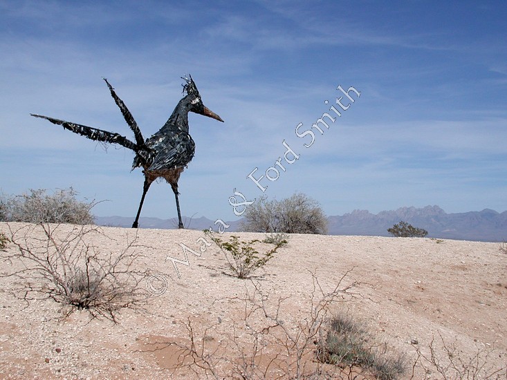
Crossing another plain, then cutting through another band of mountains, we passed white marble quarries, abandoned army forts, and budding pistachio fields before returning to yet another plain. Here an interstate highway led us through the still wintry “land of enchantment” to Texas. Along roads, we saw abandoned structures and installed sculptures, deer and jackrabbits determined to cross the road in front of our car. |
|
|
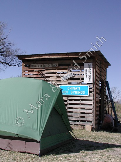
Since all Texas state parks were full for spring break, we made a stop at private Chinati Hot Springs near Presidio. Arriving near midnight, we crawled into our tent and listened to conversation around a campfire. To our surprise, all the people were against George Bush’s war plans—Minnesotans, Texans, Buddhists, even, declared Republicans! Though we didn’t join the discussion after fourteen hours of driving, we realized we’d feel comfortable soaking with these people. |
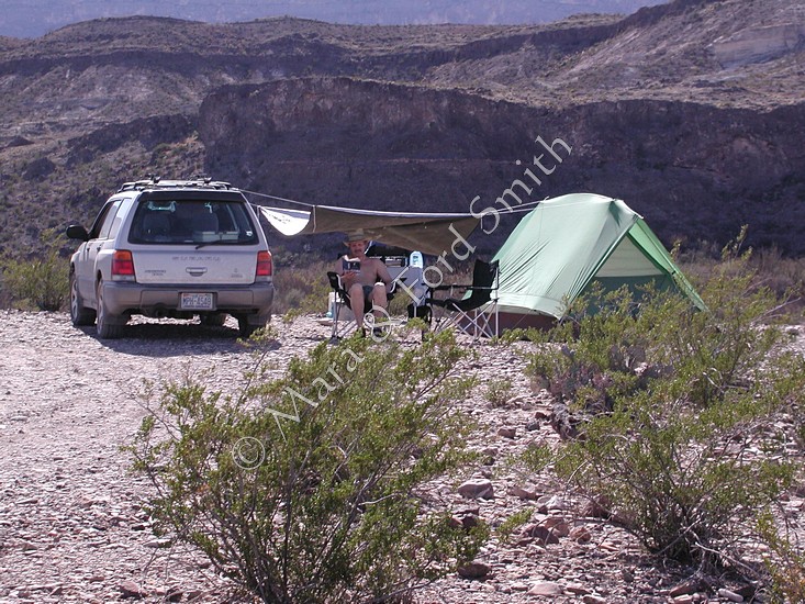
Back in Big Bend, spring break had run
its course. We were able to sign up for a backcountry site in Pine
Canyon, recommended by friend Pat Grediagin who had been the river
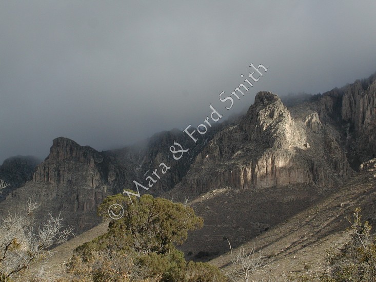
ranger there for several years. As we approached our campsite, thunder
clouds formed over the Chisos Mountains. We quickly set up tent and
table, then cooked dinner. While we ate, we talked about what we
needed to grab first, in case it started raining. We had barely finished
our last bites when raindrops started to fall. We gathered designated
articles and ran for our car, where we watched lightning and listened
to thunder over and over again. When the storm abated, we headed
for our still-standing tent. The storm circled and the entire show
happened all over again! Next morning in the desert, our tent was dry. We
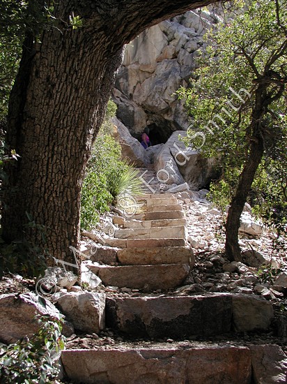
packed up to hike into Pine Canyon, filled with pine trees and
gigantic boulders. We walked to yet another towering pour-off.
Even after all the rain, though, there was only an occasional drip
from this intermittent waterfall. |
|
Driving through San Antonio, we stopped at a Mexican restaurant, Los Barrios, touted as one of 100 best new restaurants in America by Esquire and one of 50 best Hispanic restaurants by Hispanic Magazine. Ford sampled an enchilada platter with rice, beans, and guacamole salad while Mara tried a queszataco with pico de gallo and guacamole salad. The items were truly among the best Tex-Mex foods we had ever eaten. The atmosphere of the whole operation was filled with happiness and love. Owner Diana Barrios Trevino was on-hand to autograph her cookbook, Los Barrios Family Cookbook, and regale us with stories. |
|
|
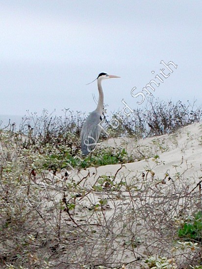
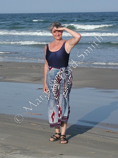
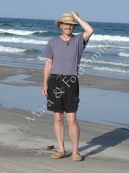
Finally, we returned to Padre Island National Seashore. This time, temperatures were normal. As usual on this trip, we arrived as the sun was setting—this time behind sea-oat and vine-covered sand dunes. Laughing gulls and brown pelicans glowed in the last rays as they flew alongside our car. We drove about five miles of hard-packed sand on this sixty-mile barrier island. In the morning, an orange sun jumped out of its blue blanket; we jumped into our swimsuits. We walked the beach; we photographed a curious Great Blue heron. Fishermen fished; horseback riders rode. When a full moon rose, we broke out a bottle of fine red wine—oh, what a day; oh, what a night! |
|
Thank goodness, we had experienced one beautiful day at the beach. Morning dawned cool and foggy. We stashed our dew-drenched tent in a garbage bag and headed for —yikes!—cold showers. Although we had not planned to drive home in approximately 24 hours, a rain started and never stopped until we drove into our driveway in Tryon, North Carolina. Taking advantage of this break, we unloaded our car; drained, filled, and restarted our hot tub; crashed in our bed.
|
 |
All of the images on this website
are available for use. To have the copyright overlay removed and/or
have the image in another size, please
contact me here. |
|||||